When we were approached to add a Catchment Report tool to our Civil3D tools package, we were pessimistic at first, since the API exposes very little about catchment objects. However, if there’s one thing we have plenty of it’s determination and after some experimentation we found a way to collect the necessary data. The results turned out better than we initially hoped.
This tool generates a detailed report of selected catchments with full control over report columns, the order displayed and more. Like all of our report dialogs we knowing that is only the beginning of the data process, that’s why all reports allow a single click export to Excel, etc.
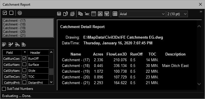
The measure of the usefulness of reporting tools is the fields available for inclusion in the report. We were able to expose a good collection, as listed below.
| Topic | Description |
| CatAreVal: | Area in the current drawing units (feet/meter). |
| CatAreAcr: | Area divided by 43560.0 (assumes feet current unit). |
| CatBndCrd: | List of catchment boundary points (3D). |
| CatBndCnt: | Number of catchment boundary points. |
| CatFloCrd: | List of catchment flowline points (3D). |
| CatFloFlt: | FlowLine 2D Length. |
| CatFloSlp: | FlowLine 3D Length. |
| CatPerFlt: | Catchment perimeter (2D) |
| CatPerSlp: | Catchment perimeter (3D) |
| CatGrpNam: | Group name. |
| CatRunCoe: | Runoff coefficient. |
| CatSurNam: | Referenced surface name. |
| CatStyNam: | Catchment style name. |
| CatTimCon: | Time of Concentration. |
| CatHydPnt: | Hydraulically Most Distant Point. |
| CatDisPnt: | Discharge Point. |
| CatDesVal: | Catchment Description. |
| CatLabStr: | Catchment Label Strings. |
This tool is available in:
- C3DTools for Civil3D (2015-2020)