When we worked up our procedure for importing Lidar into Civil3D, we realized there were way too many steps and way too many hoops to jump through. Hoops preparing the data, through Recap to prepare a RCP/RCS, through Civil3D creating a point cloud, and finally creating the surface. Highly trained professionals have more important things to do with their time than spend it like a well trained circus animal jumping through hoops, so we did something about it.
A common desire for Civil3D users is the ability to export the contents of the civil tables, which are not standard CAD tables. However, the copy to clipboard approach results in an image that (while better than nothing) will not allow data extraction by other applications. We’ve had this capability in our full C3DTools add-on for years but since everyone doesn’t have a budget for the full package, we chose to chip this one off as a more affordable option.
The update / upgrade process of C3DTools is done differently than the rest of our products. Instead of building a collection of tools that are released together annually, we develop and test each tool in house and include the new functionality right away. End users can choose when they want to download the new tool(s) by either running our Check for Updates (from the web) periodically or by downloading a replacement complete install (MSI file).
Read More →
Lidar data in its delivered state usually contains many more points than PC CAD based systems can handle. Not naming any names, but we’ve personally seem 30 million plus points bring well known PC CAD software to a grinding halt, locking up the session leading to a task manager shut down. All the points in a 30 acre project could hit that point. So there must be some filtering (weeding) in place even for small projects.
Read More →
It’s a common occurrence to receive a drawing from outside sources that do not have a coordinate system assigned. This value is easy to check at the command prompt using the CGEOCS system variable, which shows “” (blank) when the system has not been assigned.
Read More →
You may receive an ESRI Shapefile collection from a GIS user for a data source in generating a surface. This is typically a ShapeFile Type 1 (Point) or Type 2 (Polyline) which contains the XY values in the .SHP file, along with the elevations in a field of the associated .DBF file.
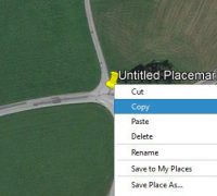
You may have noticed that when you try to copy named objects in Civil3D (or use the same name) that it will append a (1) to the name. What you might not have noticed is that if the string case of the named object varies, Civil3D will let you create what we consider to be a duplicated name !
There are times within every project where something (or many things) can gum up the works and slow your group’s productivity. The question is how prepared you are tor them in advance and how you react when they do happen. When you hit a snag and one or more team members end up spending hours doing repetitive tasks, do you dare bill for all that time?
When gravity and moisture begins to work on steep slopes (disturbed or natural) the results are often less than optimal and slides occur. This can present the need to install anchor bolts and plates going from the loose surface to a more stable rock strata underneath. Boreholes can help determine the location of the stable strata, but from the surface it’s not readily apparent how far (on a given slope) you will need to drill to reach the stable member. Read More →
November 4th, 2016 was a day to remember, as Autodesk had just released a 16.2 revision to Civil3D that provided what initially appeared to be some useful improvements to the Civil3D API (Application Programming Interface). A couple years before (11-29-2014) we had requested several improvements to the API to allow the creation and editing of FeatureLines on a level similar to polylines.