Harvests multiple drawing extents and properties (DWGPROPS), creates output drawings or reports. Export to Google Earth (KML) with preview thumbnail or web ready reports (HTM) and more.
This tool makes easy work out of creating a visual index to all your drawings (with coordinate system assigned)! Simply select a starting folder (it processes all sub-folders) or a specific collection of files.
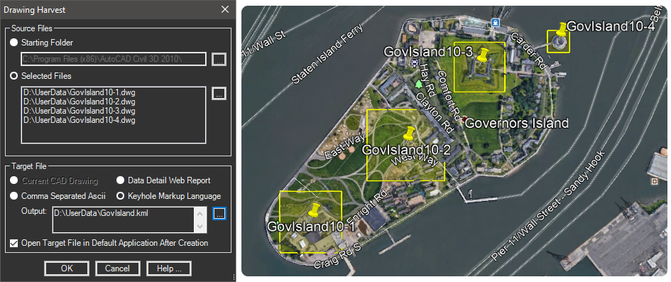
It can very quickly scan a the designated drawing files since it treats them like databases and does not open them in the CAD editor. It can then build a KML file for Google Earth showing the current extents of the drawing along with a pushpin marker at the center.

Clicking the pin in GE shows the drawing preview along with the drawing extents (coordinates) and all the DWGPROPS information.